


Voting District 1607002, Monroe County, New York
About
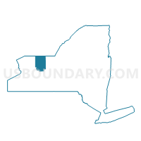
Outline

Summary
| Unique Area Identifier | 630158 |
| Name | Voting District 1607002 |
| County | Monroe County |
| State | New York |
| Area (square miles) | 0.30 |
| Land Area (square miles) | 0.23 |
| Water Area (square miles) | 0.08 |
| % of Land Area | 75.12 |
| % of Water Area | 24.88 |
| Latitude of the Internal Point | 43.25374450 |
| Longtitude of the Internal Point | -77.60982020 |
Maps


Graphs
Select a template below for downloading or customizing gragh for Voting District 1607002, Monroe County, New York


Neighbors
Neighoring Voting District (by Name) Neighboring Voting District on the Map
- Voting District 0000000, Monroe County, NY
- Voting District 0500021, Monroe County, NY
- Voting District 0500035, Monroe County, NY
- Voting District 0500082, Monroe County, NY
- Voting District 0500084, Monroe County, NY
- Voting District 0800004, Monroe County, NY
- Voting District 0800046, Monroe County, NY
- Voting District 0800049, Monroe County, NY
- Voting District 1606001, Monroe County, NY
- Voting District 1606003, Monroe County, NY
- Voting District 1607001, Monroe County, NY
- Voting District 1607003, Monroe County, NY
- Voting District 1626017, Monroe County, NY
Top 10 Neighboring County Subdivision (by Population) Neighboring County Subdivision on the Map
- Rochester city, Monroe County, NY (210,565)
- Greece town, Monroe County, NY (96,095)
- Irondequoit town, Monroe County, NY (51,692)
- County subdivisions not defined, Monroe County, NY (0)
Top 10 Neighboring Place (by Population) Neighboring Place on the Map
Top 10 Neighboring Unified School District (by Population) Neighboring Unified School District on the Map
- Rochester City School District, NY (210,596)
- Greece Central School District, NY (82,633)
- West Irondequoit Central School District, NY (23,754)
- School District Not Defined, NY (13,644)
Top 10 Neighboring State Legislative District Lower Chamber (by Population) Neighboring State Legislative District Lower Chamber on the Map
Top 10 Neighboring State Legislative District Upper Chamber (by Population) Neighboring State Legislative District Upper Chamber on the Map
Top 10 Neighboring 111th Congressional District (by Population) Neighboring 111th Congressional District on the Map
Top 10 Neighboring Census Tract (by Population) Neighboring Census Tract on the Map
- Census Tract 134.01, Monroe County, NY (4,043)
- Census Tract 102, Monroe County, NY (3,929)
- Census Tract 101, Monroe County, NY (3,799)
- Census Tract 85, Monroe County, NY (3,678)
- Census Tract 47.01, Monroe County, NY (3,033)
- Census Tract 137.01, Monroe County, NY (2,191)
- Census Tract 9900, Monroe County, NY (0)